Main Salmon
The River of No Return - big water, big beaches, warmer than the Middle Fork, and easier to draw.
The run
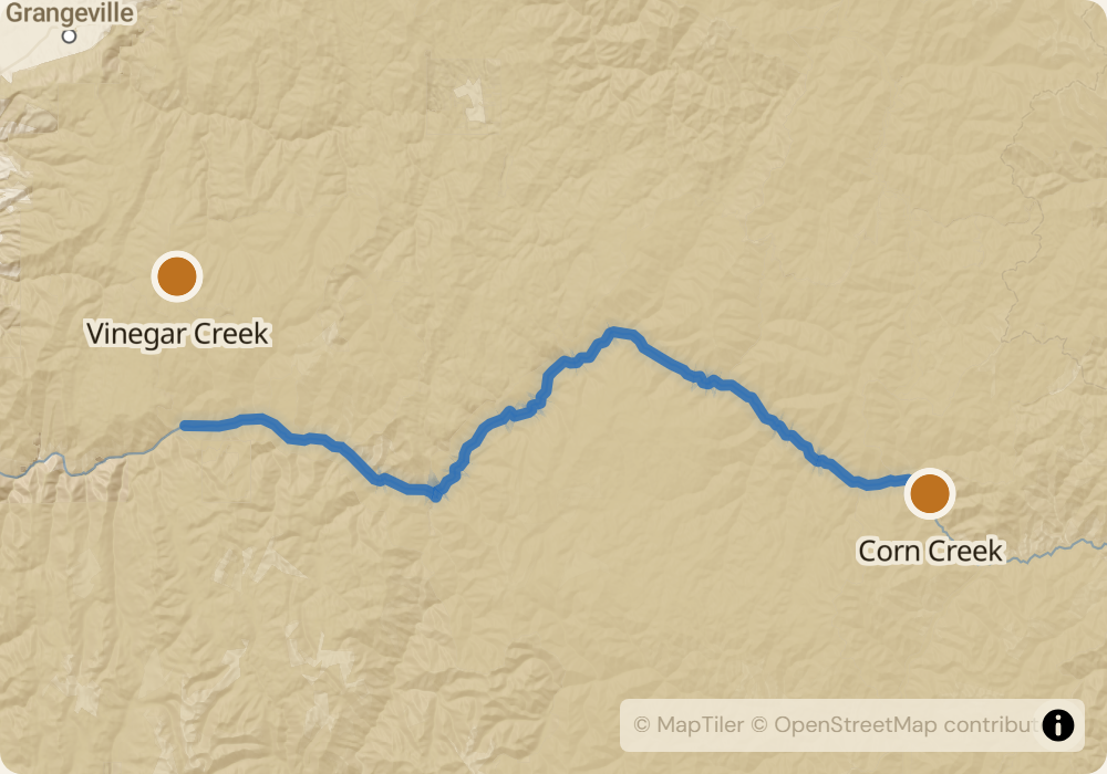
79 miles from Corn Creek down to Vinegar Creek through the Frank Church-River of No Return Wilderness. Bigger and warmer than the Middle Fork, which dumps in at Cache Bar half a mile upstream of the Main Salmon put-in. More volume, fewer technical moves, longer rapids. The water widens from 200 to 400 feet across in the lower canyon. Named Class III-IV features include Rainier, Big Mallard, Elkhorn, Whiplash, and Vinegar Creek Rapid. Most of the run is Class III with sustained sections of moving water and big wave trains between rapids. The river sits lower in elevation than the Middle Fork, so the water is warmer and the weather hotter in midsummer.
The permit
Same December-January lottery system as the Middle Fork, for launches between June 20 and September 7. Main Salmon odds are substantially better than the Middle Fork - roughly 15-20% for core weeks versus 2-3% for the Middle Fork. Permit issued in person at the Corn Creek launch by a USFS ranger. Cancellations happen through the season; parties with flexible launch dates and short-notice availability get on the river multiple times a year via cancellation monitoring.
Timing
Peak flow is late May through mid-June when the Salmon-Challis snowpack melts out - flows can exceed 15,000 CFS in heavy snow years and the river becomes genuinely dangerous. Mid-July through August is the main season: 3,000-5,000 CFS, warm air, readable water, dry camps. By September flows drop to 2,000-3,000 CFS and the technical moves come back. Pick the window for the kind of trip you want: June for big water, July-August for classic, September for cool nights and low traffic.
Logistics
Put-in is Corn Creek at the Middle Fork confluence, reached by gravel road off US-93 about 45 miles west of Salmon, Idaho. Take-out is Vinegar Creek, 10 miles upstream of Riggins. Shuttle is 250+ miles around through McCall or Grangeville; $500-800 with a commercial operator. Salmon, ID is the closest full-service town at the put-in side. Riggins has gas, a few restaurants, and limited groceries.
Monitor Main Salmon for cancellations
We poll recreation.gov every minute and email you the moment a permit opens up. No app, no hype, just the alert.
Start monitoring