Hells Canyon
The deepest gorge in North America - 7,900 feet from He Devil Peak down to the Snake - and dam-controlled flows that run all season.
The run
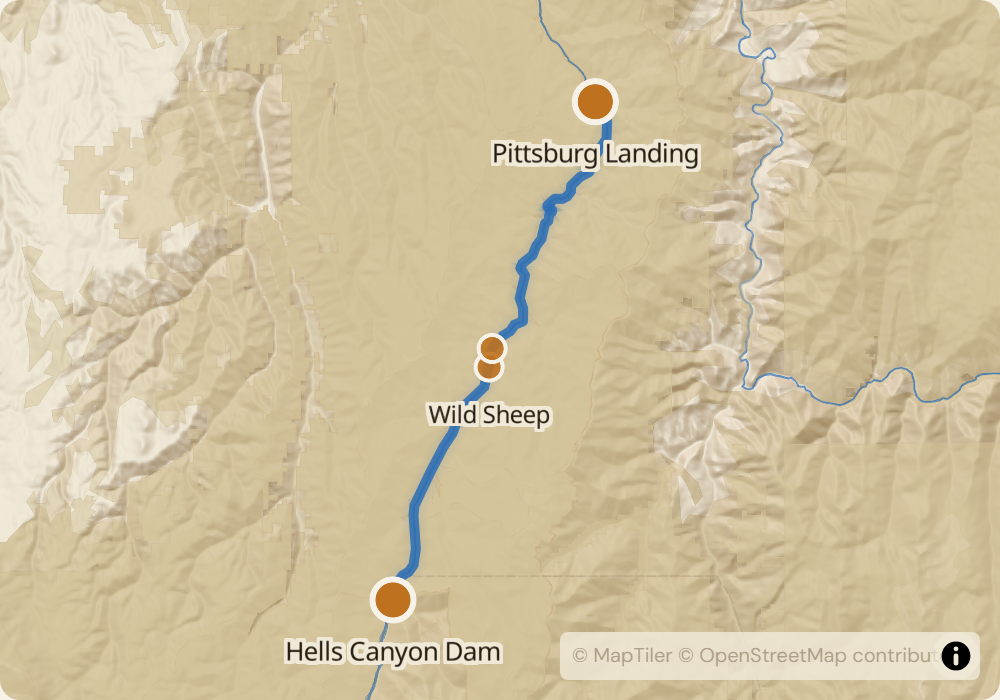
79 miles from Hells Canyon Dam to Heller Bar through a canyon 7,900 feet deep from rim to river. Dam-controlled, so flows are steady through the season: Idaho Power targets 10,000-17,000 CFS during raft months. The Class IV rapids are early and concentrated: Wild Sheep Rapid at mile 14 and Granite Creek at mile 15, both scoutable on river-right. The rest of the run is wave-train Class III with rapids spaced out between long flatwater stretches. Petroglyphs at Kirkwood Ranch, Nez Perce history throughout, bighorn sheep and rattlesnakes on the beaches.
The permit
Lottery runs December 1 through January 31 for launches between May 15 and September 15. Odds are moderate - roughly 15-25% for midsummer weekends. Many parties skip the full permit and take jet-boat shuttles from Heller Bar up to Hells Canyon Dam instead, which doesn't require a permit; self-supported full-length runs do. Cancellations trickle out through the season and a monitor is most useful for short-notice weekend trips.
Timing
Dam releases hold the river at 10,000-17,000 CFS through the raft season. Early season (May) is colder and quieter with more wildlife on the beaches. July and August are the hottest months - canyon temperatures routinely exceed 105F. September is good for steelhead and cooler weather. The water itself is relatively warm because dam releases come off the top of the reservoir, unlike the Middle Fork or Main Salmon.
Logistics
Put-in is Hells Canyon Dam on the Oregon-Idaho border - paved but winding road, 2 hours from Cambridge, ID or New Meadows. Take-out is Heller Bar on the Snake-Grande Ronde confluence, Washington side. Shuttle is 300 miles one way through Lewiston and Clarkston - $900-1,200 with a company. Pittsburg Landing at mile 32 is a common take-out for shorter trips; that shuttle is shorter and cheaper.
Monitor Hells Canyon for cancellations
We poll recreation.gov every minute and email you the moment a permit opens up. No app, no hype, just the alert.
Start monitoring